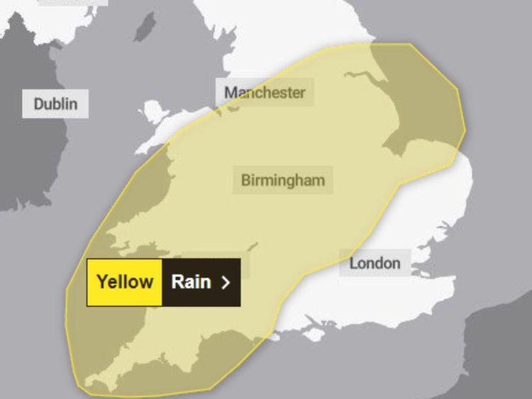
More heavy rain on the way weather warning issued for Shropshire

The yellow warning is due to start at 5pm today and be in force until 9pm tomorrow (Tuesday).
It is bad news for those who are hoping for dry weather to allow the rivers and flood plains to recover from recent deluges.
Flood barriers are already up in Shrewsbury and Ironbridge and there are multiple weather warnings and alerts in place. The Government's flooding service is saying that the rivers will remain high and there could be a number of peak flows through the system.
The Met Office says parts of the Midlands could receive from just over half an inch (15mm) to nearly two inches (50mm) or rain in the 28 hour warning period as two distinct bands of weather head across England and Wales.
A spokesperson for the Met Office said: "Following recent wet weather, further spells of rain, heavy in places are expected on Monday evening and overnight.
"Then after a brief gap, another spell of heavy rain is likely to spread northeastwards on Tuesday."
They say that the focus this evening and overnight will be across parts of southwest and southern England, south Wales and perhaps the Midlands.
Tuesday is "less clear cut" but they say that the focus for the heaviest rain is"perhaps more likely" across parts of Wales, the Midlands towards eastern England and Yorkshire.
"Over the warning period, 15 to 30 mm rain is likely to fall fairly widely, with a few places seeing 35 to 50 mm," the Met Office says.
Dave Throup, a retired Environment Agency Area Manager has tweeted that "more flooding is inevitable."
He posted on X that it is "definitely not what’s needed."
"15-30mm falling widely and up to 50mm locally. Falling on saturated ground and very full rivers.
"More flooding inevitable."


