Apple Maps: Topographic maps announced at WWDC 2024
At WWDC 2024, Apple Maps for iOS received an update that will please outdoorsy types and, perhaps, geologists: topographic maps.
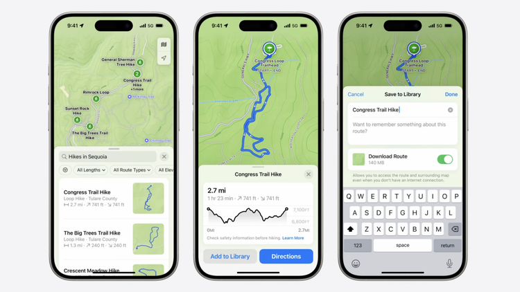
Apple Maps now includes an option to view topography — similar to an option added to WatchOS 10 last year — allowing users to see the natural curves and features of an area. During the WWDC demo, the topography shown to viewers was out in nature, showing an almost entirely green-tinted view with shading to indicate hills, and topographical lines to indicate changes in elevation.
In this context, "topography" naturally also includes at least one non-natural feature: trail networks and hiking routes. Trails for all 63 U.S. national parks will be included, according to the keynote.
Mashable Light Speed
Trail directions will come with the option to receive spoken, turn-by-turn guidance, which will work even in online mode — provided you downloaded your map.
When searching for trails, the user can simply hit a toggle to download a given trail map. This will come in handy for anyone using their iPhone to navigate a nature walk off the grid, or anywhere with patchy mobile phone service.
The feature also boasts the ability to create your own hikes — an intriguing option we at Mashable look forward to testing out. Nature is, after all, full of cliffs, colonies of wild animals, and raging, uncrossable rivers, so we generally stick to the hikes other people have created. But this level of customization is putting us in an adventurous mood.


